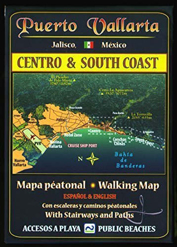
A full-color, highly detailed panoramic map of Puerto Vallarta’s Old City and the areas along the shore south to Los Arcos National Park. Oriented toward the needs of the pedestrian, but equally useful to drivers, the Puerto Vallarta Walking Map shows pedestrian footbridges, stairways and paths; major and minor landmarks; locator buttons for 18 sites of interest to the traveler, most hotels, villas, and condos; and the lay of the streets in the hills. At a compact folded size of 5 x 7 inches, it is easy to peruse while on foot or behind the wheel. Full (unfolded) size is 14 x 20 inches. MAPA JEFF (Jeffrey F. Obser) is a professionally trained journalist and editor who took up illustrative cartography during long residence and research on-site in Mexico. His maps portray the land in an unconventional three-dimensional style that is both easy to grasp and filled with useful current information. All Mapa Jeff maps are printed in small batches and updated frequently as information changes.